
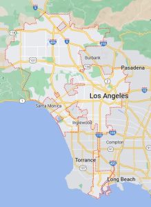
Los Angeles is a sparawling city, the third largest in North America after New York City and Mexico City with a population of just over 3.8 million people. It is the home to much of America’s film industry, the Hollywood sign and the Walk of Fame.
I had reason one day to look at a map of Los Angeles under Google Maps. I was more surprised to find out what wasn’t part of LA almost as much as what was. Looking at the map, there is this thin strip running south to Long Beach — except that Long Beach isn’t actually part of LA. It runs next to Long Beach. Torrance and Inglewood are our first enclaves, being surrounded by either the Pacific Ocean or LA. In this part of LA, I am also glossing over other weird things the border seems to do around Long Beach, and this nameless enclave which seems to pop out of nowhere:
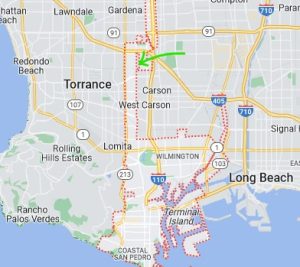
It is basically a rectangle of land completely surrounded by LA. But there is also Culver City with the same situation. Santa Monica and Marina Del Rey are that way too, surrounded on all other sides by LA but for the Pacific Ocean. But probably the most famous enclaves are Beverly Hills, West Hollywood, and Universal City. While San Fernando is definitely an enclave, Burbank and Pasadena are not, not being surrounded on all sides by Los Angeles. And there are more namless enclaves, such as the one that pops out of nowhere in Franklin Canyon Park just north of Beverly Hills.
And there is another nameless enclave near UCLA between Sanata Monica and Beverly Hills:
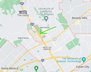
It has plenty of places apparently affiliated with Veterans Affairs with “Los Angeles” in the name, but are not actually part of LA. Looks federal.
Los Angeles is on the far south of California. The next major city further south would be San Diego, near the Mexican border. Rather than enclaves, San Diego appears to have two or more exclaves: parts of San Diego which are separate from the main city, and surrounded by other geographic areas.
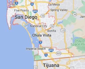
The most striking exclave of San Diego is the one bordering Mexico, a few miles south of the main part of the city, surrounded only by Chula Vista, Imperial Beach, a national park, and the Mexican city of Tijuana.
I try to think of what Canadian equivalents are there to such crazy borders. Toronto is a poor candidate, being a nearly rectangular city with no enclaves or exclaves to speak of. Toronto is a simple layout, extending as it does between Etobicoke Creek in the east to Rouge Valley Park on the Scarborough outskirts in the west; then from Steeles Avenue in the north, proceeding south to Lake Ontario. Simple. Toronto may have had such weird borders at one time, but amalgamation in the 1990s of the “5 boroughs” (Etobicoke, North York, East York, metro Toronto, and Scarborough) made it simple, as well as making it North America’s fourth largest metropolis, trailing Los Angeles in population.
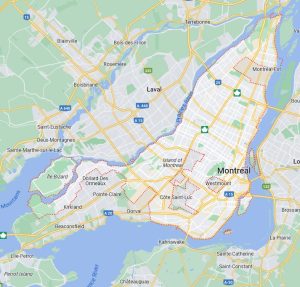
But there is Montreal, Canada’s second largest city. Bill 22 back in the Rene Levesque days made the province of Quebec largely unilingual and French within a bilingual country. To this day, there are still English-speaking neighbourhoods which are not actually part of Montreal. In particular, Hampstead, Westmount, and Mount-Royal (to the point of having English stop signs, and apparently being exempted from the French-only signage law). Other enclaves are Cote Saint-Luc and Montreal-West, which are more bilingual, are surrounded by Montreal. Another enclave is an industrial district connected with Montreal-East, if you ignore that it is bounded by the St. Lawrence River to the east.
Montreal had always been confusing to me for another reason. The island lies along the river at a kind of slant from southwest to northeast. Coming from Toronto, I am used to the body of water (Lake Ontario in the case of Toronto) lying to the south, with streets generally running east-west parallel to the lake; while cross streets were generally north-south; making it easy to get the compass directions pretty much correct. You can’t do that with Montreal.
The main part of the St. Lawrence River lies to the south, or depending on where you are, to the east. So if you are used to having the body of water to the south, you’re in trouble. The streets run east to west from the eastern river (or really is it southeast to northwest?), while the cross streets such as the Trans-Canada Highway run north-south (or more precisely southwest to northeast).
Visits: 208