Mile zero ot the Caledon Trail is a good ways away from where I live, and not all of it is highway driving, since it is far away from the 401, the 403, the 407, and any of the “400 series” expressways. Most of the drive was through Winston Churchhill Boulevard, which gradually narrows from 6 lanes to 2 lanes as you approach Terra Cotta, where the Mile Zero marker is located. You then need to enter a dirt road with an initial sharp incline called Brick Lane and travel it to the end to see the trail.
The distance from home to the trail is further away (41 km) than the trail itself, so I drove. Since I left around 11 AM or so, it was already getting hot, and so I didn’t carry the bike in the van. Today was about seeing how easy or difficult it was to get to the Mile Zero marker, and then looking around. There were no issues, except right around Mile Zero, King St. breaks up Winston Churchhill into two sections, and you had to find the northern section to get to Brick Lane. Not that hard with a map, which I had.
The small bit of looking around I did was extremely helpful in planning my ride, when I decide to embark. It will likely be useful to divide the route into 3 sections of about 10 km each, which makes a ballpark cycling distance twice that, due to the return journey. The trail goes across main streets and towns, so it is possible to stop where I last turned back the previous day and do a new journey for another 10 or so kilometers.
More of my thoughts are below. To see the illustrations in “gallery mode”, click on a graphic, and it will behave as a slideshow. The captions are below that, and you need to click just below the caption to read the whole thing.
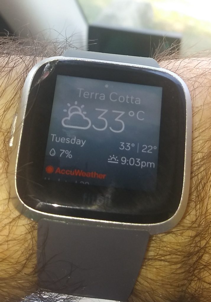
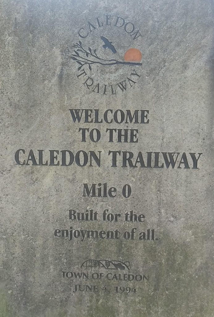
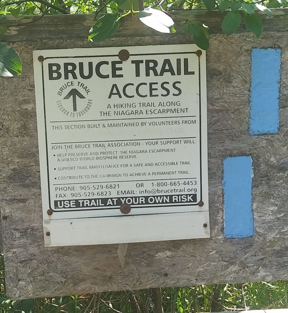
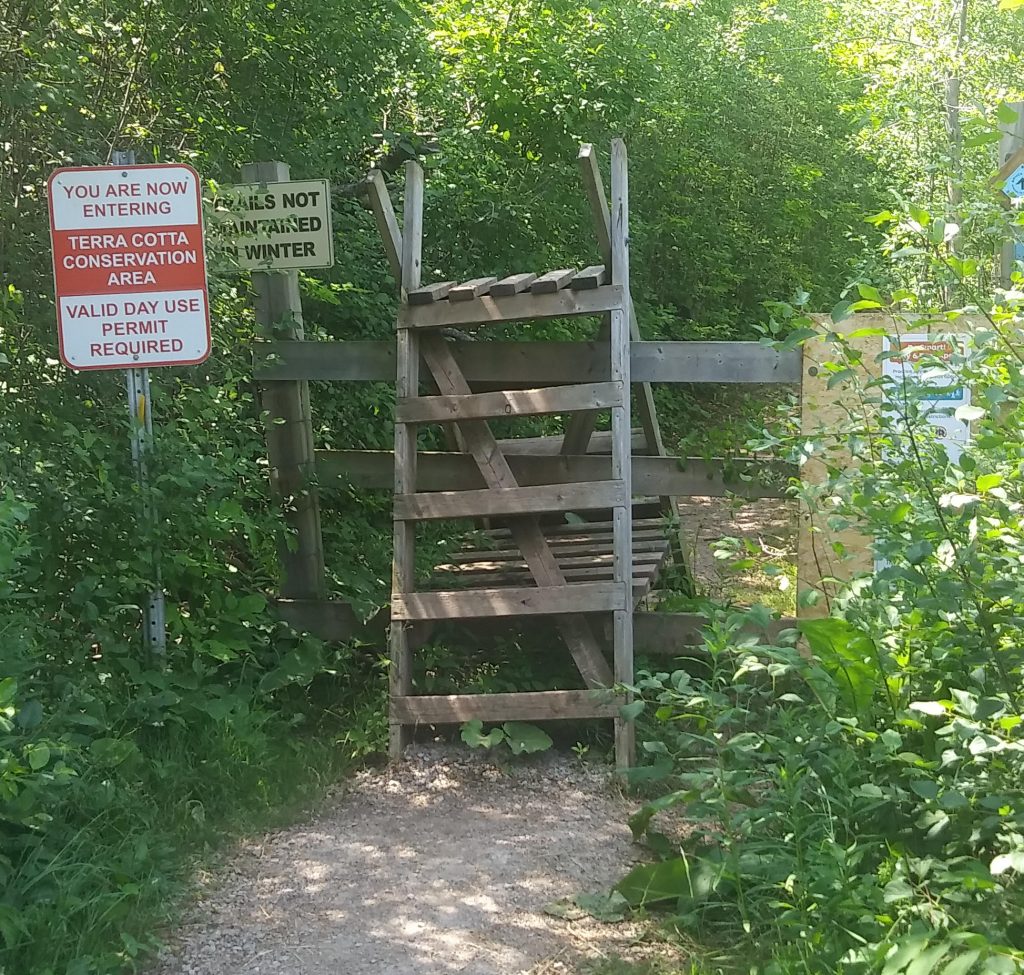
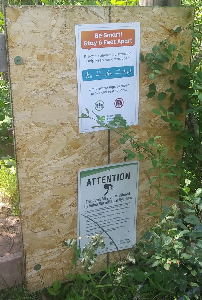
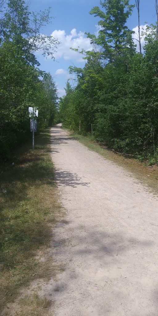
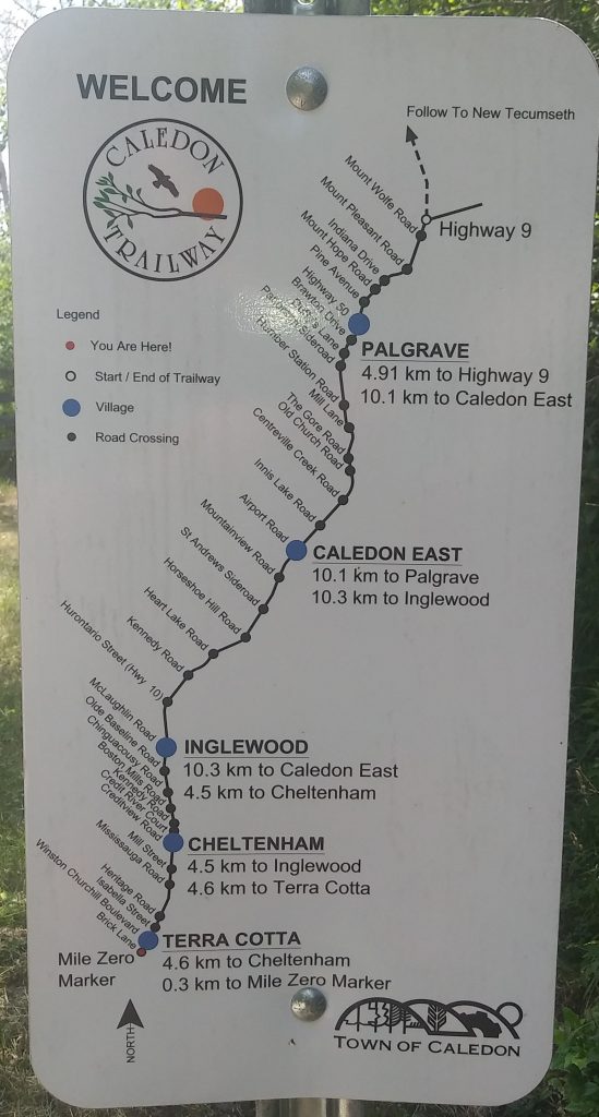
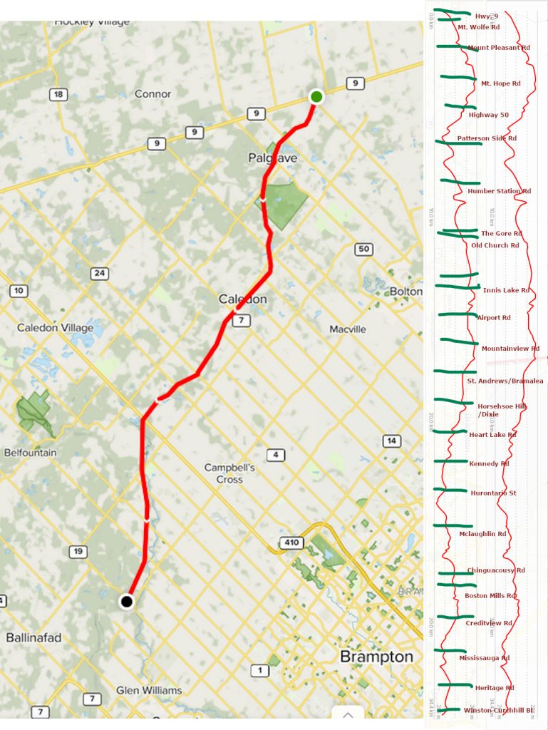
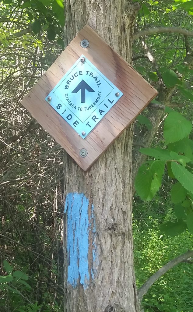
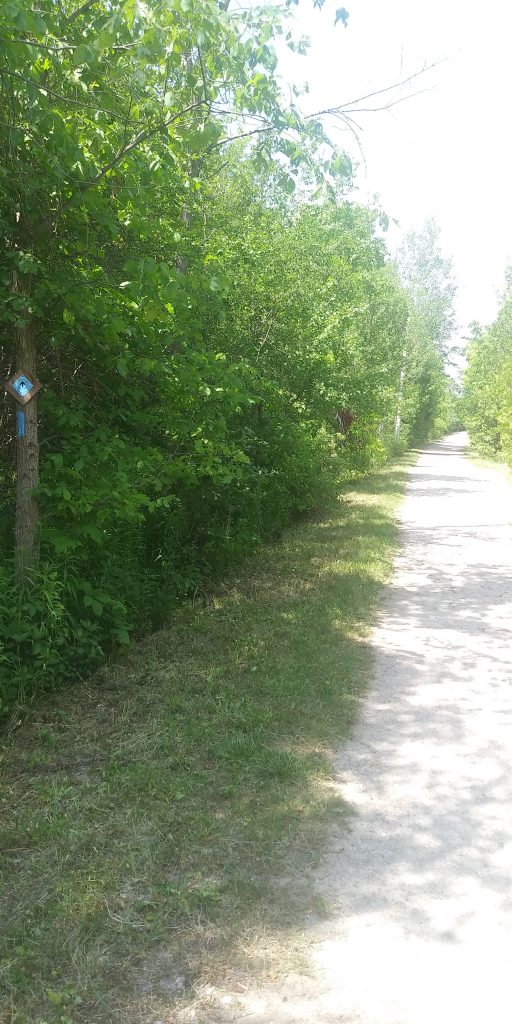
Well, I wasn’t seriously having a look at the trail to travel it by bike today. The sun up here in Terra Cotta was pretty brutal, and while my watch reports 33C, Environment Canada reported 34C at Pearson, with the humidex at 39C. In imperial units, while it was 93F, it felt like 102F.Just outside where I parked my vehicle, is mile zero on the Caledon Trailway. The trail begins at the extreme end of a dirt road called Brick Lane which was off Winston Churchhill Blvd, in the village of Terra Cotta. This sign is made of stone with the letters and logos sandblasted into the rock.And beside that marker, was this other sign for a different trail. This one was strictly a hiking trail. It is a much more ambitious trail, as it apparently goes from Niagara to Tobemory, at the tip of the Bruce Penninsula, close to 250 km, or a 3-hour drive from here. Niagara is about a 1-hour drive in the other direction.The next couple of photos have to do with the entrance to the Bruce hiking trail. I would consider travelling this trail, but it has a strange barrier at the start of the trail, with a number of signs.There was enough attention paid to the hiking trail for someone to put up a social distancing sign, and apparently there are cameras about. I am unsure of how they are getting electricity to run the cameras so far into the wilderness.This reminds travellers that this is a side trail which runs through the Terra Cotta Conservation Area. These blue painted rectangles are also seen on trees to remind travellers that they are still on the right trail.Back on the Caledon Trail. This is a look down the very start of the trail. The very first sign has a handy map of the trail. The Caledon Trail extends from here, which is just inside Wellington county (borders with Peel) to Tottenham in Simcoe county. The rest of the trail is (hopefully) like what I see here, with packed, fine gravel and sand along its length. It means my bicyle can probably handle this, but sharp downhills will make stopping very difficult, since my bicycle is a commuter with smooth treads. There will be times I will have to walk my bike downhill rather than take the hill (grumble, grumble) 🙁Peel region follows Lake Ontario, extending from the lake to the northwest direction, ending in Dufferin and Simcoe counties. On a Peel map, the Caledon Trail would appear to go “east-to-west” on Caledon, but is actually going north, due to Peel region being on a slant. The length is around 34.4 km from end to end, if you only go as far as the Simcoe border, marked here as “Highway 9”.The caledon trail, showing where the hills are for planning my bike ride. A GIMP’ed graphic with pieces from alltrails.com appears here. The green marks I made indicate the streets at particular elevations along the journey. The differences between the highest and lowest elevations are around 30m. The trail is around 34.4 km long.The Caledon Trail, according to this marker found on a tree, shows that the it is a continuation of the footpath shown on a previous photo, of the Bruce Trail.Even though we are a fair distance away from urban sprawl, the Caledon Trail is wide, and the trees don’t appear to overhang the trail a whole lot. This goes back to this trail’s history as a former railway track, which extended as far as Barrie. As a consequence, the trail would appear to have very little shade in hot weather.